|
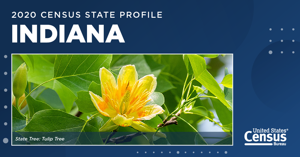
Celebrating Indiana's 207th Anniversary of Statehood
Indiana became the 19th state on December 11, 1816. Explore Census Bureau data about Indiana using 2020 Census data, geographic profiles from data.census.gov, and other interactive data tools.
|
|
Population and Demographics
Indiana is the 38th largest state by area. Learn more about the geography and history of Indiana.
Did you know:
- The top employed industry is educational services, health care, and social assistance.
- The percentage of people who moved to Indiana from a different state in the last year was 2.2%.
- The average commute is 24.1 minutes, compared to the United States average of 26.4 minutes.
Learn more about the state's business and economy on data.census.gov.
2020 Census Data
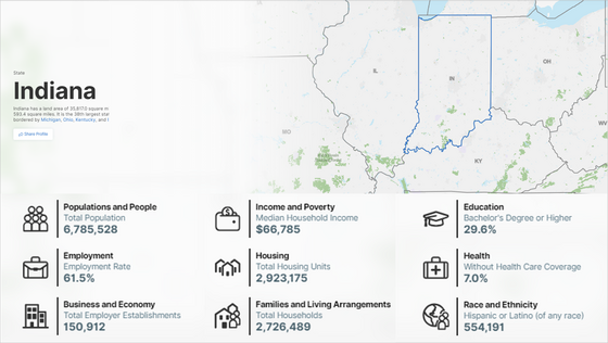
Indiana's population was 6,785,528 in 2020, a 4.7% increase from 2010.
The results of the 2020 Census show that:
-
1,592,949 or 23.5% of people in Indiana were under age 18. That's a decrease of 1.0% from 2010 to 2020.
-
554,191 or 8.2% of people in Indiana reported Hispanic or Latino origin. That's an increase of 42.2% from 2010 to 2020.
|
|
Fun Facts
🐦 The state bird is the Cardinal.
💧 The state beverage is Water.
🌇 The largest city is Indianapolis.
🔎 Explore our State Facts for Students tool to learn more about Indiana and test your knowledge of Census Bureau data with interactive games from Statistics in Schools.
Help us spread the word about Census Bureau data!
Share this on social media or forward it to a friend.
|
|
Featured Resources for State Data
Check out these interactive data tools that you can use to find data about your state.
|
|
About the Census Bureau
We serve as the nation’s leading provider of quality data about its people and economy. The Census Bureau is the federal government's largest statistical agency. As the world’s premier statistical agency, we are dedicated to making our nation a better place. Policy-makers, businesses, and the public use our data to make informed decisions.
|
|
|
|