
Official websites use .gov
A .gov website belongs to an official government organization in the United States.
Secure .gov websites use HTTPS
A lock (
) or https:// means you’ve safely connected to the .gov website. Share sensitive information only on official, secure websites.

Topics
Data & Maps
Surveys & Programs
Resource Library
2020 Population Distribution in the United States and Puerto Rico
2020 Population Distribution in the United States and Puerto Rico
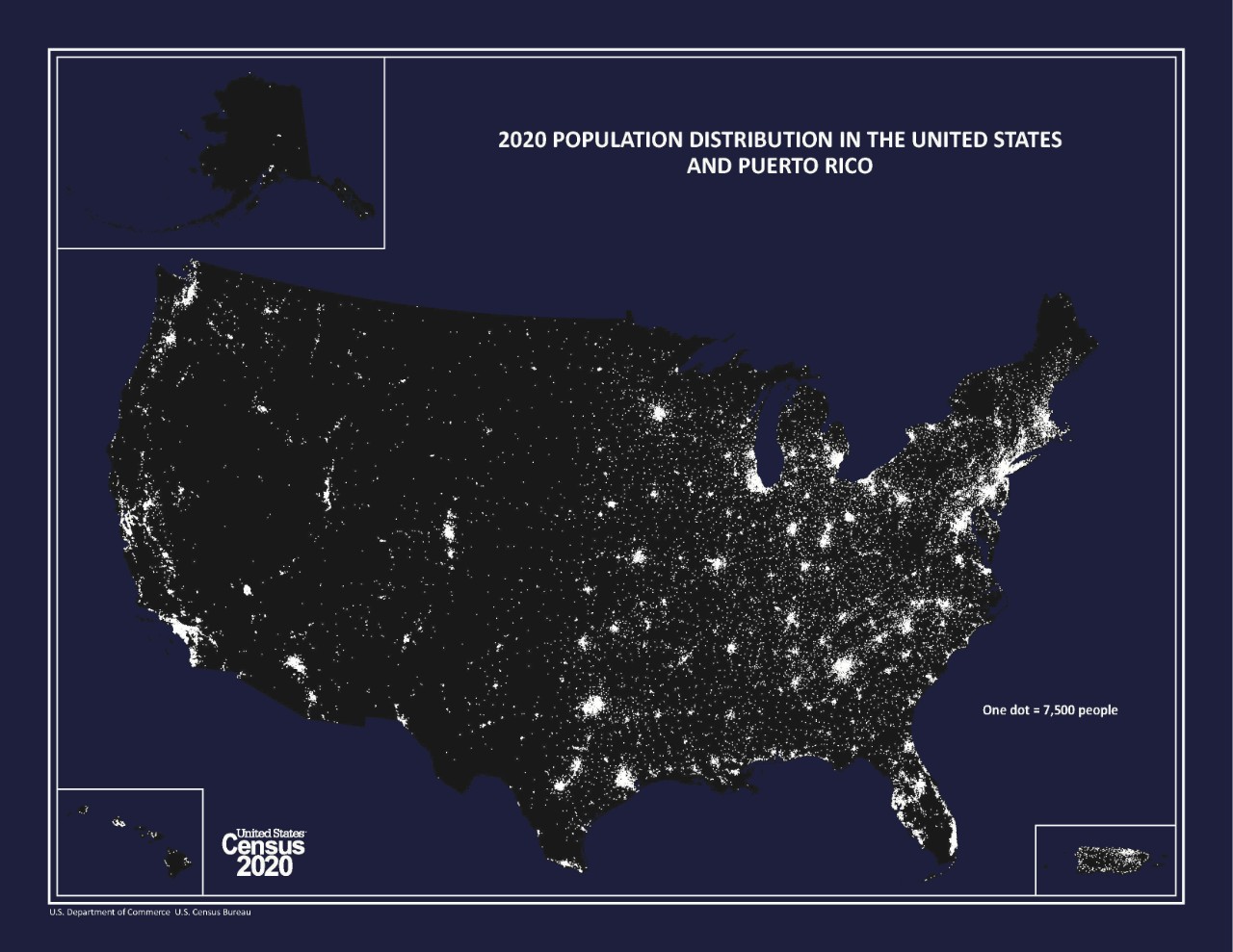
The 2020 Population Distribution in the United States and Puerto Rico map (also referred to as the "Nighttime Map") portrays the distribution of population in the United States and Puerto Rico based on the results of the 2020 Census of Population and Housing. Two versions of this dot distribution map are available: a large format map and a small format map. On the large format or wall map version (which measures approximately 28 x 24 inches), each white dot represents 1,000 people. On the small format or page size version (which measures 11 x 8.5 inches), each white dot represents 7,500 people.

Related Information
Page Last Revised - March 20, 2023
✕
Is this page helpful?
 Yes
Yes
 No
No
 Yes
Yes
 No
No✕
NO THANKS
255 characters maximum
 255 characters maximum reached
✕
Thank you for your feedback.
Comments or suggestions?

Comments or suggestions?