
end of header
History
You are here: Census.gov › History › Reference › Maps › 1950 Census Tract Map of Washington, DC
Maps
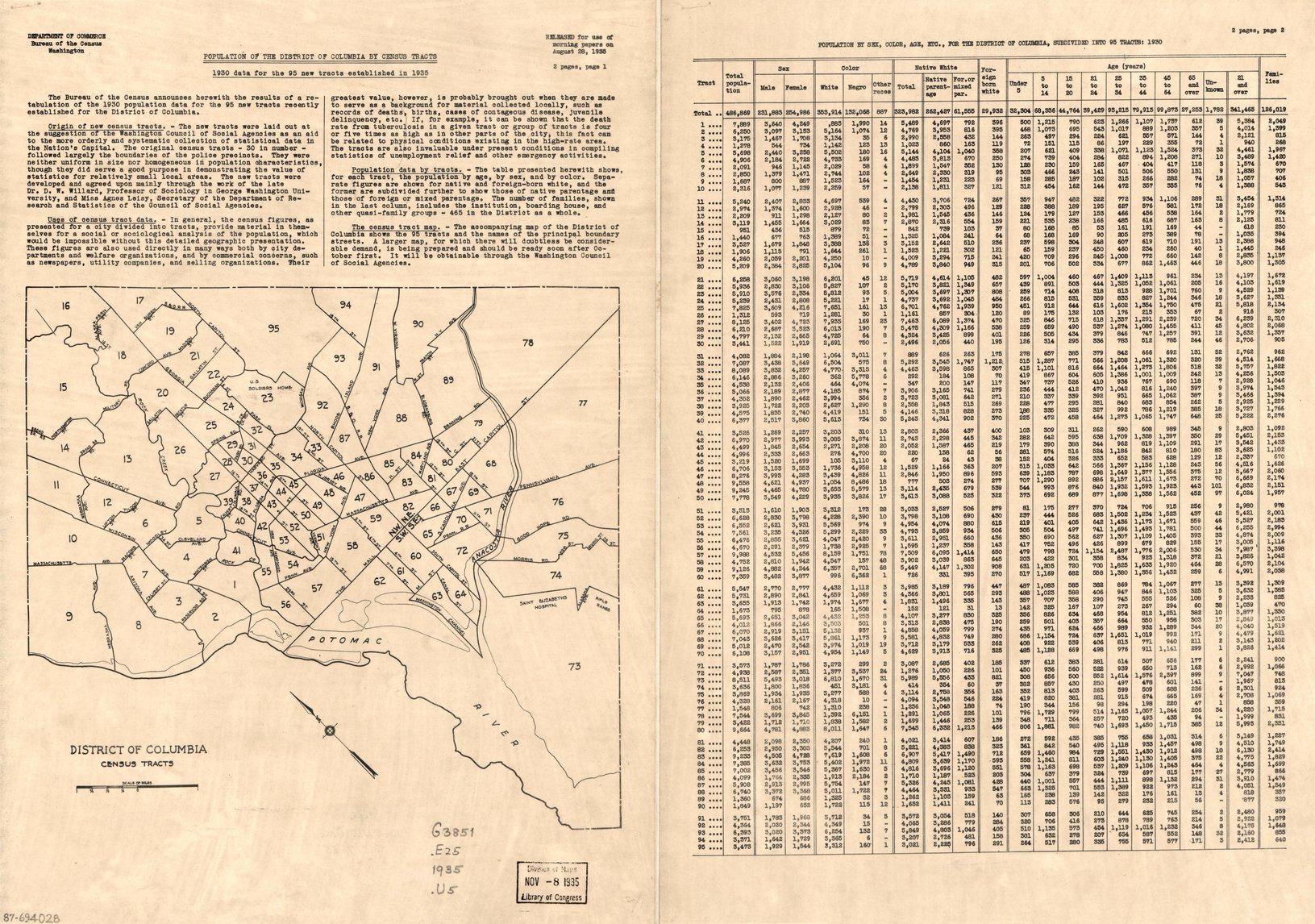
Washington, DC, Census Tracts: 1930
At the time of the 1930 Census, our nation's capital was divided into 30 census tracts that were generally defined by the city's police district boundaries. These boundaries worked well for law enforcement, but were increasingly becoming obsolete for statistical purposes as the District of Columbia's population changed. In response to a recommendation by the Washington Council of Social Agencies, we expanded the number of census tracts from 30 to 95 in 1935 and re-tabulated the 1930 Census data. Tract borders were defined by major roads like Florida and Massachusetts Avenues, as well as geographic features including the National Mall and Anacostia and Potomac Rivers. The accompanying table provides the 1930 population data for each of the city's 486,869 inhabitants, for each tract, by sex, race, and age; foreign born White; and the number of families.
Click here to view a larger image of the 1930 Census tracts.
View larger image.
1930 Census Tracts for Washington, DC.
Photo courtesy of the Library of Congress.
 Yes
Yes
 No
No
Comments or suggestions?