
end of header
History
You are here: Census.gov › History › Programs › Geography › Island Areas
Geography
Island Areas

Guam has been included in the decennial census
since 1920. The poster above was used to raise
awareness of Census 2000.
In addition to the 50 states and District of Columbia, the U.S. Census Bureau also conducts censuses and surveys in the United States' Island Areas. Census and survey operations are conducted in cooperation with the governments of the Island Areas and frequently include modifications to the questionnaires to help the local and federal governments better understand the populations being counted.
Currently, the decennial and economic censuses include the following Island Areas:
- Puerto Rico. The island of Puerto Rico was first enumerated by the Census Bureau for the U.S. War Department in 1899, following the Spanish-American War. The results of this special census were published in the Report on the Census of Porto Rico, 1899. Puerto Rico has been included as part of the decennial census since 1910. The Census Bureau conducted the first economic census in Puerto Rico in 1909. With the exception of 1929, the agency conducted a census in Puerto Rico at 10-year intervals through 1949, after which it was taken concurrently with censuses of retail and wholesale trade and selected service industries, for the years 1954 and 1958. The census in Puerto Rico has been part of the stateside economic census program since 1963. Since Census 2000, Puerto Rico has received the same census questionnaire (in Spanish) as the rest of the United States.
- U.S. Virgin Islands. The Census Bureau conducted the first census in the U.S. Virgin Islands in 1917. The results of the enumeration were published in the Census of the Virgin Islands of the United States, November 1, 1917. The island's government conducted a census in 1930, and the Census Bureau enumerated the Virgin Islands as part of the 1940 and subsequent censuses. Economic census data (relating to retail trade) were collected for the U.S. Virgin Islands in 1958, and expanded to include additional areas of the economy during subsequent censuses.
- Guam. The island of Guam has been part of the decennial census since 1920. Data from the 1920 census for American Samoa are contained in several population bulletins published [ZIP 171.2 MB] between 1920 and 1921. Economic census data (relating to retail trade) were collected for Guam in 1958, and expanded to include additional areas of the economy during subsequent censuses.
- American Samoa. The first decennial census was conducted in American Samoa in 1920. Data from the 1920 census for American Samoa are contained in several population bulletins published [ZIP 171.2 MB] between 1920 and 1921. American Samoa was included in the economic census for the first time in 2002.
- Commonwealth of the Northern Mariana Islands. The Census Bureau conducted the first decennial census in the Northern Mariana Islands in 1970. Also during that year, the first agriculture census was taken. The islands were included in the economic census beginning in 1982.
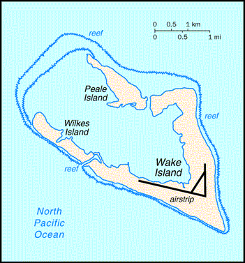
Famous for the role it played during World War II, Wake Island
has been reported as a populated area starting with the 1950
census. It became a U.S. possession in 1898, and has been
administered by the U.S. Air Force since 1962.
The Census Bureau included other entities as Outlying Areas in earlier decennial censuses:
- The Canal Zone (or Panama Canal Zone) was first enumerated by the United States in 1904, after it came under U.S. jurisdiction by treaty with Panama on November 18, 1903. It was included in the decennial censuses from 1920 through 1970. On October 1, 1979, the United States transferred sovereignty over the Canal Zone to Panama in accordance with the terms of a treaty signed in September 1977 and ratified the following April.
- The Trust Territory of the Pacific Islands (TTPI) was administered by the United States as a United Nations trusteeship beginning July 18, 1947. The TTPI included the Marshall, Caroline, and Northern Mariana Islands, as well as Palau. The U.S. Navy conducted a population census of the TTPI in 1950, the Office of the High Commissioner of the TTPI conducted censuses in 1958 and 1973, and the Census Bureau conducted the censuses in 1970 and 1980. However, for the 1980 census, the Census Bureau reported the Northern Mariana Islands as a separate entity rather than with the other entities that composed the TTPI. On November 3, 1986, a presidential proclamation canceled the trusteeship agreement as it applied to the Northern Mariana Islands, and that entity became a commonwealth of the United States. As a result of the proclamation, effective November 9, 1986, the Federated States of Micronesia (comprising the TTPI administrative districts of Kosrae, Ponape [now Pohnpei], Truk [now Chuuk], and Yap) and, retroactive to October 21, 1986, the Republic of the Marshall Islands, became freely associated states, independent of the United States except for U.S. responsibility for their security and defense. On December 22, 1990, the U.N. Security Council officially terminated the TTPI jurisdiction over all areas except Palau. Palau became a "freely associated state," on October 1, 1994, ending the TTPI jurisdiction. Palau was included in the decennial census from 1970 to 1990.
Additionally, the Census Bureau provided population counts for certain small islands under U.S. jurisdiction in accordance with an agreement with the Department of State. These islands include: the Corn Islands; Navassa Island, Quita Sueño Bank, Roncador Cay, and Serrana Bank; Baker, Howland, and Jarvis Islands; Canton and Enderbury Islands; Johnston Atoll; Kingman Reef; The Midway Islands; Palmyra Atoll; and Wake Island.
For more information about the history of the censuses in the Island Areas and U.S. territories (including several not mentioned above), see Chapter 7, "Puerto Rico and the Outlying Areas," of the Census Bureau's Geographic Areas Reference Manual.
 Yes
Yes
 No
No
Comments or suggestions?