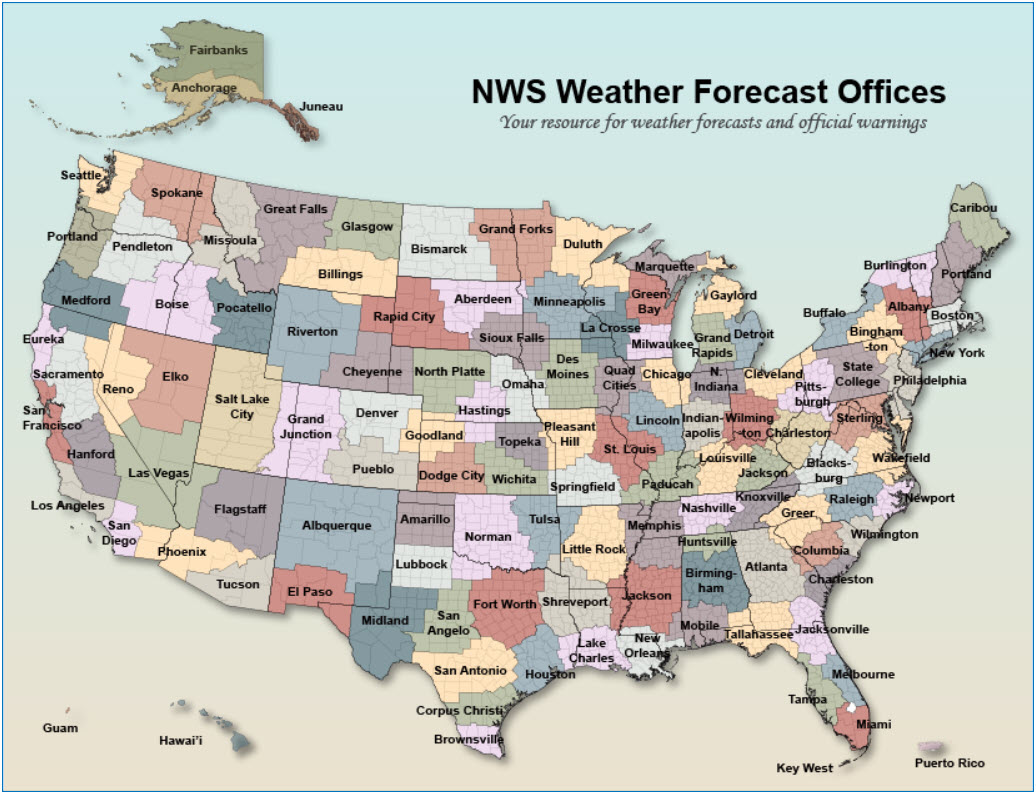
NOAA's National Weather Service (NWS) Weather Forecast Offices (WFOs)
NOAA's National Weather Service (NWS) Weather Forecast Offices (WFOs)
Each weather forecast office (WFO) has a geographic area of responsibility, also known as a county warning area (CWA), for issuing local public, marine, aviation, fire, and hydrology forecasts. The Census Bureau provides key demographic and business data that weather forecasters and broadcasters can use in their work.
Select the map to view the NOAA WFO site.
The table below provides direct links to both the map and report in Census Business Builder for all 122 WFOs. CBB provides access to over 150 of these data variables for potentially impacted areas. Users can not only view the combined data for each WFO as a whole but also for the counties, cities/towns, ZIP Codes, and Tracts within the CWA.
Census Business Builder
Related Information
Page Last Revised - November 22, 2023


