Using the Census Bureau Planning Database with the Response Outreach Area Mapper (ROAM)
Using the Census Bureau Planning Database with the Response Outreach Area Mapper (ROAM)
Description
The Planning Database (PDB) contains select 5-year ACS estimates, 2010 Census operational variables, and the Low Response Score (LRS). The LRS is the predicted percent of households that will not self-respond in a given block group or census tract. New to the 2019 PDB are ACS 5-year internet access statistics and 5-year ACS self-response rates at the tract level.
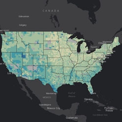
The Response Outreach Area Mapper (ROAM) is an interactive mapping application, developed to make it easier to identify hard-to-survey areas and the socioeconomic and demographic profiles of those areas. It is based on a subset of PDB data at the census tract-level, including the LRS, poverty status, education level, race, Hispanic origin, and language spoken at home.
Speakers
Chase Sawyer, American Community Survey Office
Kathleen Kephart, Center for Survey Measurement
Suzanne McArdle, Geography Division
Webinar Materials

Related Information