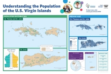
SIS K-12 Map: Understanding the Population of the U.S. Virgin Islands

This map illustrates census data about the U.S. Virgin Islands for students in grades K-12. It will help students in the U.S. Virgin Islands better understand their population and their community by showing data on population density, median age, and more.
Access the Map
Page Last Revised - September 19, 2022


