Population Shift to the West and South
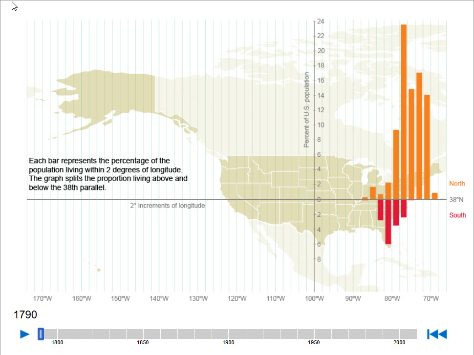
The 100th meridian generally defines the boundary between the humid eastern and arid western parts of the United States. Historically, living west of the 100th meridian has meant a reliance on irrigation for successful agriculture and substantial settlements were limited in size. The 38th parallel divides the country based on average July temperature, with most of the country below the parallel experiencing average July temperatures of over 80 degrees. The completion of large-scale dam projects in the early 20th century generated water and electricity that made it possible for large cities to develop in the West. The widespread use of air conditioning after the 1970s helped make living in hotter parts of the country more tolerable.
Activity Using This Resource
Using Interactive Maps to Interpret U.S. Territorial Expansion
Students will explore an interactive data visualization of state-by-state population growth as measured by the decennial censuses of 1790 through 2010.