
Official websites use .gov
A .gov website belongs to an official government organization in the United States.
Secure .gov websites use HTTPS
A lock (
) or https:// means you’ve safely connected to the .gov website. Share sensitive information only on official, secure websites.

Topics
Data & Maps
Surveys & Programs
Resource Library

2020 Census: Address Canvassing Operation
News Release
Press Release
U.S. Census Bureau Announces the Start of First Major Field Operation
On August 12, the U.S. Census Bureau briefed the media on the launch of address canvassing, the first major field operation of the 2020 Census.
Press Release
Inicio de la primera operación de campo para el Censo del 2020
La Oficina del Censo informó sobre el inicio del recorrido de direcciones que perfecciona la lista de.


Archived Video: August 12, 2019 - News Briefing to Announce First Major Field Operations for 2020 Census


Purpose of Address Canvassing
The Address Canvassing Operation serves two purposes:
- Deliver a complete and accurate address list and spatial database for enumeration.
- Determine the type and address characteristics for each living quarter.
This operation implements methods to improve and refine the U.S. Census Bureau’s address list in advance of the 2020 Census. The Census Bureau needs the address and physical location of each living quarter in the United States and Puerto Rico to conduct and tabulate the census. An accurate list ensures that residents will be invited to participate in the census and that the census counts residents in the correct location.
Video: Address Canvassing for the 2020 Census
Address Canvassing is Now Conducted in Two Ways:
In-Office Address Canvassing uses imagery to detect housing change or stability over time throughout the United States and Puerto Rico and to compare the number of housing units on the ground to the number in the Census Bureau’s Master Address File. In-Office Address Canvassing was part of a suite of nationwide in-office methods used by the Census Bureau to maintain and update its address list, including processing of address lists from the US Postal Service and tribal, state, and local governments.
In-Field Address Canvassing, field staff, known as listers, visit specific geographic areas within the Self-Response type of enumeration area (TEA) where in-office methods could not assure a complete and accurate address list. Listers identify every place where people could live or stay, comparing what they see on the ground to the existing census address list and verifying, correcting, or adding address and location information, as appropriate. Listers knock on doors at every structure in order to verify or update information and inquire about additional living quarters in the structure and/or on the property. If the lister does not find anyone at home, they verify or update address information by observation.
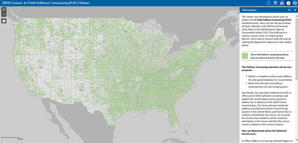
2020 Census: In-Field Address Canvassing (IFAC) Viewer
Updating and Validating the Address Frame
The Address Canvasing Operation is part of a suite of processes employed by the Census Bureau to update and validate the address frame for the 2020 Census prior to Census Day:
- Biannual processing of the U.S. Postal Service’s Delivery Sequence File (DSF).
- Tribal, state, and local government address lists and roads files provided through the Geographic Support System (GSS) Program.
- Ungeocoded Resolution Project, in which Census Bureau staff research and identify the census block to which an address should be assigned when the automated geocoding process is unable to make the determination.
- Local Update of Census Addresses (LUCA) Program and the LUCA Appeals process (provides an opportunity for tribal, state, and local governments to review the Census Bureau’s address list for their respective jurisdictions).
- New Construction Program is available to local governments to provide addresses for housing units built after LUCA and ready for occupancy by Census Day.
- Count Review is conducted in collaboration with state demographer members of the Federal-State Cooperative for Population Estimates (FSCPE). It provides an additional opportunity to review counts of housing units prior to the 2020 Census and update as necessary.
Each of these programs and processes serves to validate addresses in the Master Address File, correct address locations and provide addresses that may not be included in any of the other address datasets. Taken together, along with in-office address canvassing and in-field address canvassing, this suite of programs and processes provides multiple opportunities for the Census Bureau to develop an accurate address list.

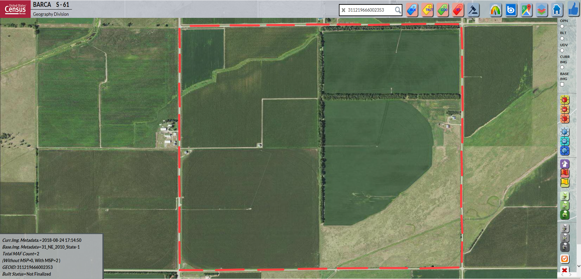
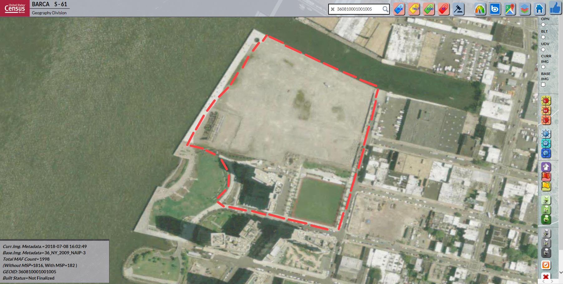
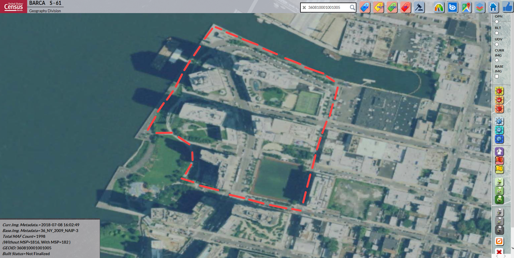
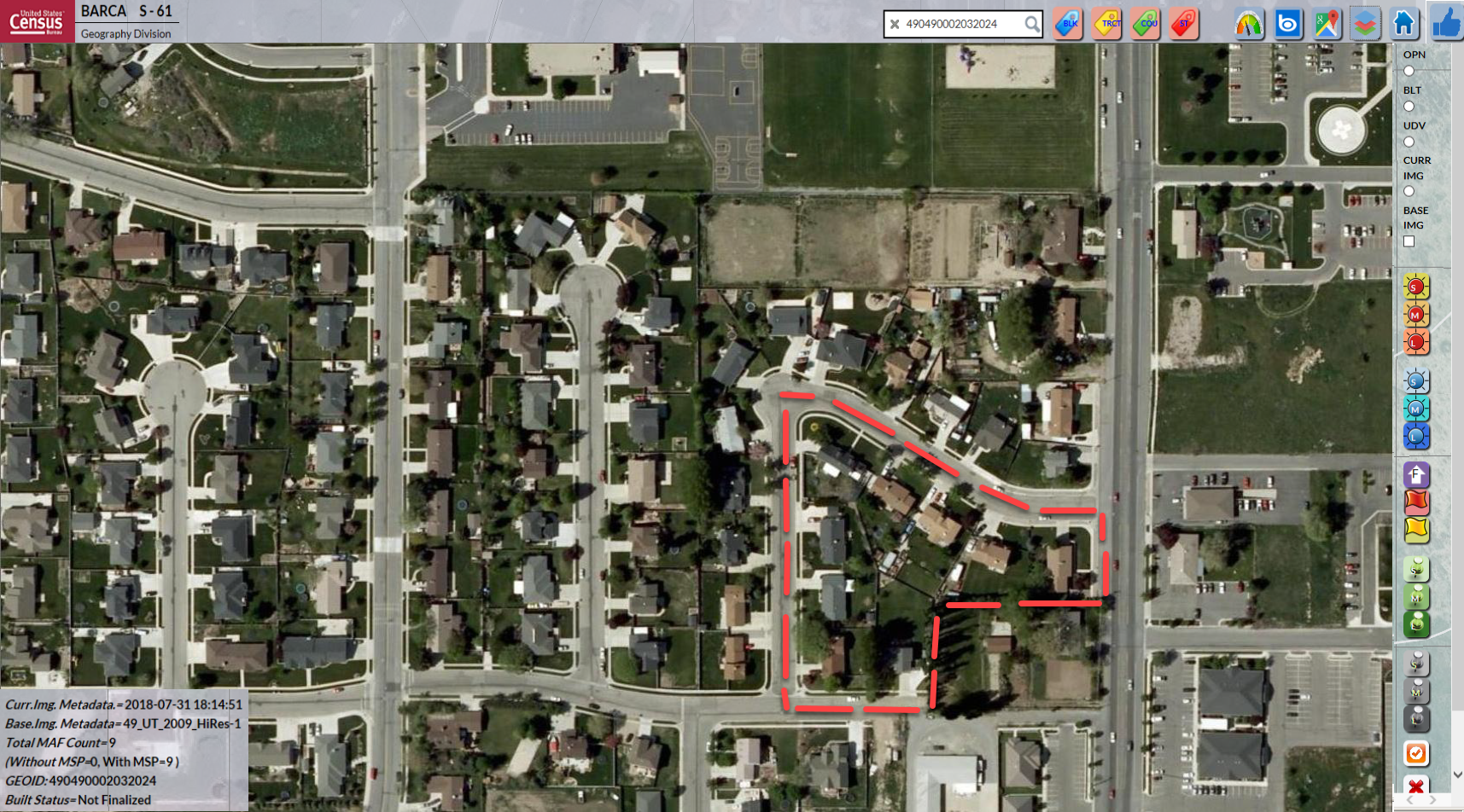
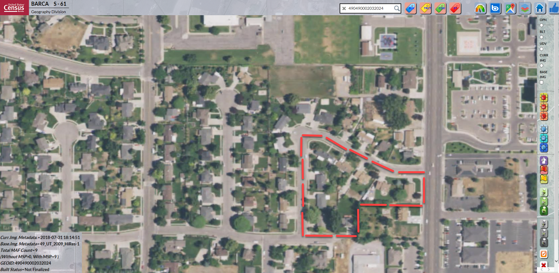
Block Assessment, Research and Classification Application (BARCA)
The Census Bureau developed the Block Assessment, Research, and Classification Application (BARCA) for use in conducting In-Office Address Canvassing. BARCA provides reviewers with access to baseline (circa 2010) and current imagery to assess change or stability in housing within each of the 11.1 million census blocks over time. Reviewers also use BARCA to compare the number of housing units visible in current imagery with the number of addresses in the Census Bureau’s address list for each block.
Individual census blocks are classified as:
- “passive” if the number of housing units visible in current imagery match the number of addresses in the MAF.
- “active” if comparison of imagery to the MAF detected undercoverage or overcoverage in the MAF.
- “on hold” if census blocks for which the in-office address canvassing reviewer could not make a determination, generally due to cloud cover in imagery.
- “trigger” for address updates from the DSF or tribal, state, or local governments as well as new imagery that prompts a re-review using BARCA.
Blocks that are in active or on-hold status in the Spring 2019 will be sent to in-field address canvassing for resolution.
BARCA Examples:
Related Press Kits
Press Kit
2020 Census
The U.S. Census counts every resident in the United States. It is mandated by Article I, Section 2 of the Constitution and takes place every 10 years.
Press Kit
2018 Census Test
The 2018 Census Test supports the goal of the 2020 Census, which is to count everyone once, only once and in the right place.
Press Kit
2020 Census LUCA Operation to Begin
LUCA is a voluntary, once-a-decade opportunity for governments to add, correct or delete addresses on the lists and maps used to conduct the decennial census.
Page Last Revised - October 28, 2021
✕
Is this page helpful?
 Yes
Yes
 No
No
 Yes
Yes
 No
No✕
NO THANKS
255 characters maximum
 255 characters maximum reached
✕
Thank you for your feedback.
Comments or suggestions?

Comments or suggestions?