
Official websites use .gov
A .gov website belongs to an official government organization in the United States.
Secure .gov websites use HTTPS
A lock (
) or https:// means you’ve safely connected to the .gov website. Share sensitive information only on official, secure websites.

Topics
Data & Maps
Surveys & Programs
Resource Library

Washington, D.C. 150th Government Anniversary (1871): February 21, 2021
Press Release Number CB21-SFS.23

From the Guide to 2010 State and Local Census Geography — District of Columbia — History:
“The area of the District of Columbia was part of the original territory of the United States. The District of Columbia was formed from territory ceded by Maryland and Virginia in 1788, and was established in accordance with Acts of Congress passed in 1790 and 1791. Its boundary, a square ten miles on a side with vertices at the cardinal points to resemble a diamond, was established on March 30, 1791, and included all of the territory within present-day Arlington County, Virginia, and part of Alexandria city, Virginia. The portion south of the Potomac River was retroceded to Virginia in 1846.
“Census data for the District of Columbia are available beginning with the 1800 census.”
Key Stats
From QuickFacts: statistics for all states and counties, and for cities and towns with a population of 5,000 or more.

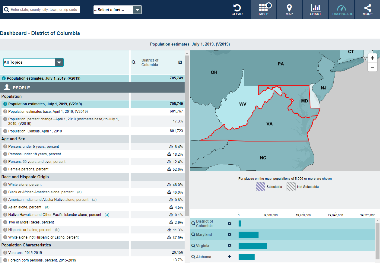
Note: The dashboard shown above is cropped at the bottom. Click on the image to see the full dashboard.
More Stats
From data.census.gov:

Source: 2019 American Community Survey (ACS) 1-Year Estimates.
From the State Data Center (SDC) Program:
From Foreign Trade > U.S. International Trade Data:
Note: After you create an account, you can choose between State Export Data (Origin of Movement) or State Import Data (State of Destination) by Harmonized System (HS) or NAICS. For more information, see the Quick Start Guide.
From the Newsroom > Stats for Stories (SFS):
From U.S. Census Bureau History (in order by publication date, newest to oldest):
From the Statistics in Schools (SIS) program:
Page Last Revised - October 8, 2021
✕
Is this page helpful?
 Yes
Yes
 No
No
 Yes
Yes
 No
No✕
NO THANKS
255 characters maximum
 255 characters maximum reached
✕
Thank you for your feedback.
Comments or suggestions?

Comments or suggestions?