Massachusetts 235th Anniversary of Statehood (1788): February 6, 2023
Massachusetts 235th Anniversary of Statehood (1788): February 6, 2023
The area of Massachusetts was part of the original territory of the United States. It was originally included in the Charter of New England in 1620; the Charter of Massachusetts Bay, which became the Constitution of the Massachusetts Bay Colony in 1629; and a charter that united the Massachusetts Bay and Plymouth colonies in 1691. In 1785, it ceded area to the United States that became part of the Northwest Territory in 1787. Massachusetts ratified the U.S. Constitution on February 6, 1788; it was the sixth of the original 13 states to join the Union. At the time of statehood, the area of Maine was a district in Massachusetts. In 1819, it agreed to allow its district of Maine to petition for statehood, and Maine was admitted to the Union as a separate state on March 15, 1820. There were changes to the boundary between Connecticut and Massachusetts in 1804 and between Rhode Island and Massachusetts in 1862, and a resurvey of the latter boundary in 1897, resulting in generally the same boundary as the present state. Massachusetts is one of four states that are legally described as a commonwealth.
Census data for Massachusetts are available beginning with the 1790 census. The population data for 1790, 1800, and 1810 do not include the area of Maine. The population of the legal area of Massachusetts including the area of Maine for those censuses was 700,745 in 1810; 574,564 in 1800; and 475,327 in 1790.

Key Stats
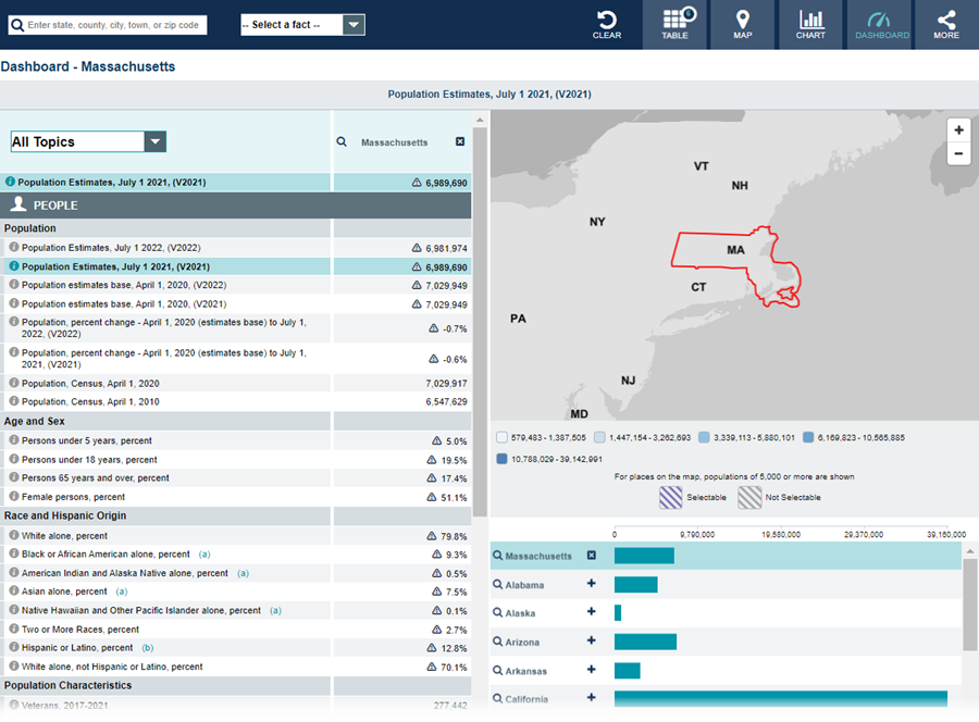
From Census.gov / Data:
Note: The dashboard above is cropped at the bottom. Click on the image for the full dashboard.
More Stats
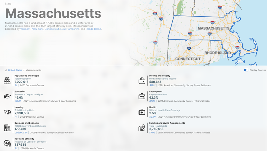
From data.census.gov:
Note: The profile above is cropped at the bottom. Click on the image for the full profile.
Source: 2021 American Community Survey (ACS) 1-year estimates.
Source: U.S. Census Bureau, Population Division (Annual Estimates of the Resident Population).
Source: 2018 - 2021 Annual Survey of Manufactures (ASM).
Source: 2020 Annual Business Survey (ABS) Program.
Source: 1978-2020 Business Dynamics Statistics (BDS).
Source: 2020 County Business Patterns (CBP).
Source: 2019 Nonemployer Statistics (NES).
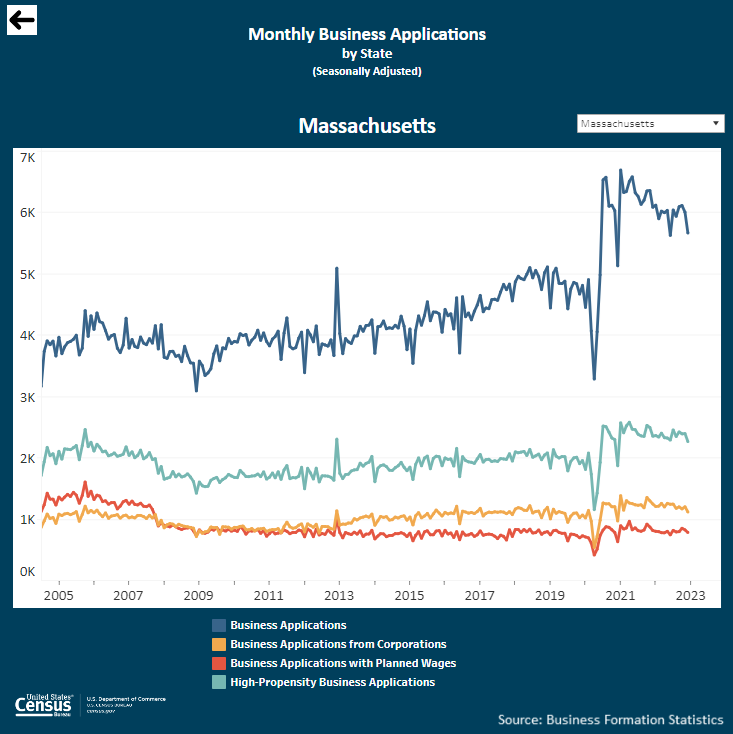
Source: Business Formation Statistics (BFS).
Note: Click on the image above to go to the Business Formation Statistics data page. For the Massachusetts graphic, scroll down to “Interactive Graphs.” Click on the icon for “Monthly Business Applications by State (BA)” and select “Massachusetts” in the upper-right drop-down area.
From Foreign Trade > International Trade Data:
Note: After you create an account, you can choose between State Export Data (Origin of Movement) or State Import Data (State of Destination) by Harmonized System (HS) or NAICS. More information is available in the Quick Start Guide.
Source: Monthly State Retail Sales.
From the State Data Center (SDC) Program:
From the Library > America Counts: Stories Behind the Numbers:
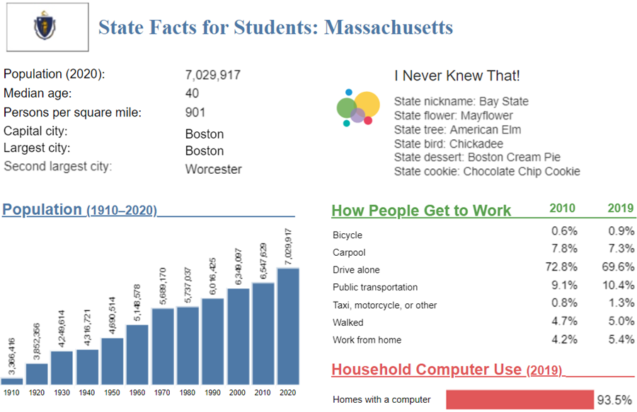
From the Statistics in Schools (SIS) program:
Note: The Massachusetts page is cropped at the bottom. Click on the image above to go to the “State Facts for Students” main page. Then, use the drop down to select “Massachusetts” or click “MA” on the map for the full page for Massachusetts.
Source: 2017 Economic Census.
From Census.gov > History:


