How can I group (or aggregate) geographies in the Microdata Access Tool?
The geography group feature allows you to get data for multiple geographies already added together for you in the Microdata Access Tool (MDAT).
For example, let’s say you are interested in getting data for Clark County, WA. In this county, there are four Public Use Microdata Areas (PUMAs) that neatly cover the county. This allows you to add up data from these four PUMAs to get data for Clark County overall.
If you would like the site to automatically add up the data for the combined area of Clark County, use the geography group functionality in MDAT following these steps:
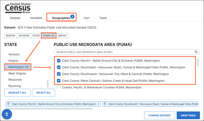
- Select the individual geographies that you want to group together.
For example: Geographies → PUMA → Washington → select the four PUMAs in Clark County, WA
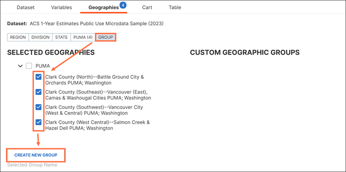
- Click the "Group" tab, mark the check boxes for the geographies you want to group together (i.e. the four PUMAs in Clark County), and click "Create New Group."
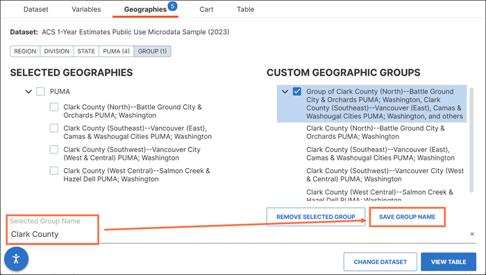
- Optional: Rename the group. For example, type "Clark County" in the Selected Group Name box and click "Save Group Name."
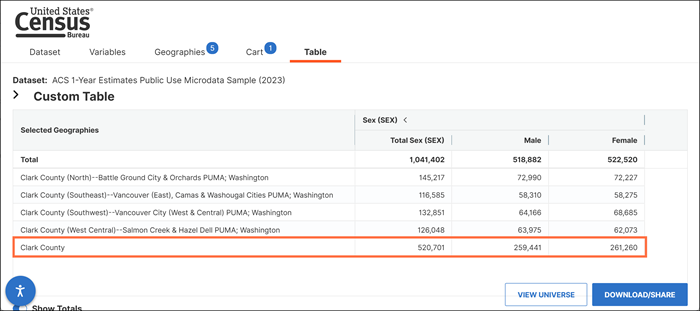
- View table. Data for your geography group(s) are shown in the bottom rows or far right columns of the table.
Please be aware that just like other estimates in MDAT, the site does not have the capability to provide margins of error (MOEs) for these estimates.
Contact Us
Email us at [email protected] for any questions or comments you may have. For more guidance on data availability and using data.census.gov, the Census API, and Microdata Access, visit our Resources page.