Demobase Rwanda
Demobase Rwanda

Demobase Rwanda
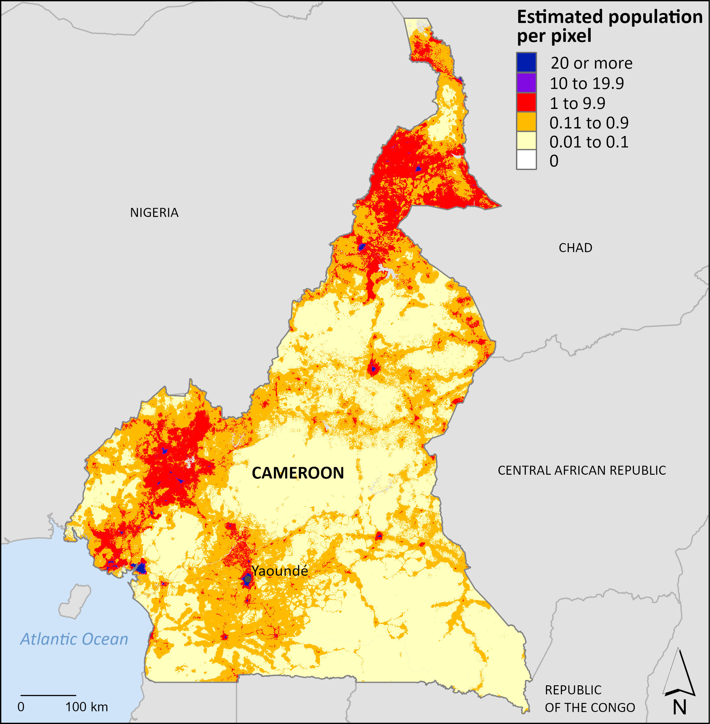
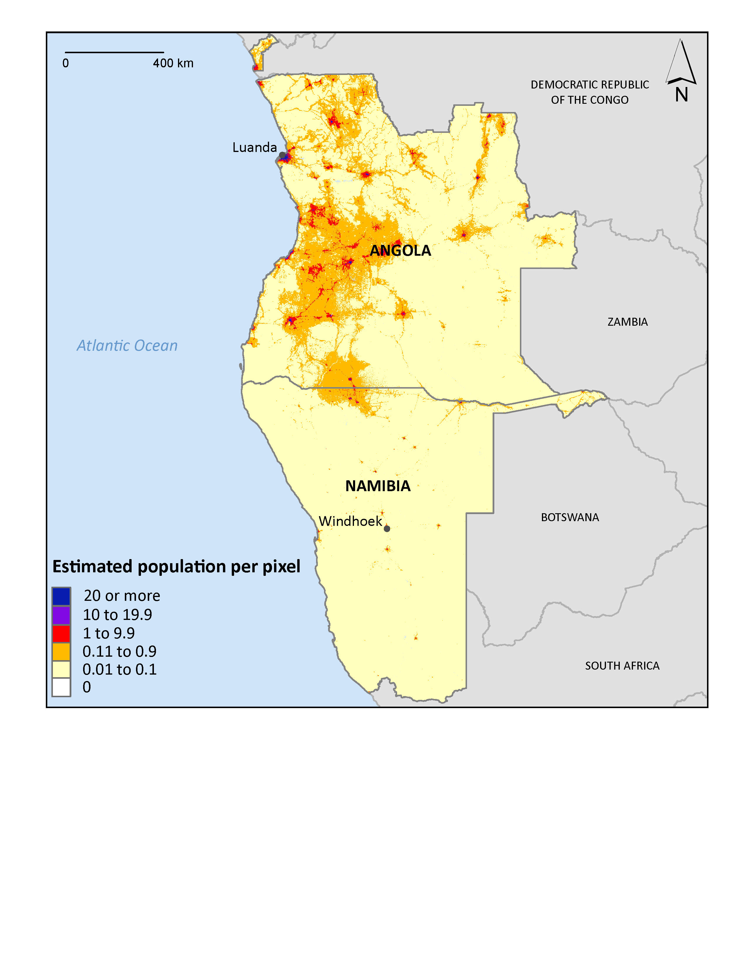
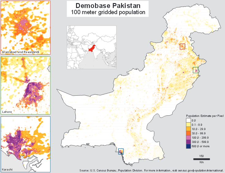
Using the same methods applied to Pakistan, the Census Bureau mapped Rwanda, a country with a substantial, dense rural population. Satellite imagery was combined with data from the 2002 Census of Rwanda to produce a geospatial distributed population layer.
Data Download

Other Demobase Visualizations

Related Information
Page Last Revised - September 23, 2025