2025 Geography Changes
ACS Documented Changes
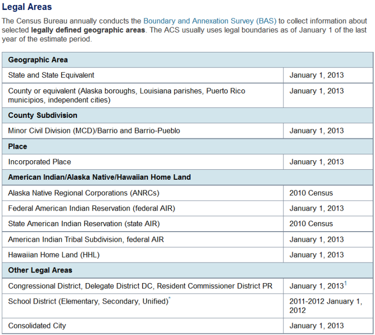
Each year some new entities come into existence and other entities are dissolved. This may be the result of new incorporations or statistical delineations, the redrawing or splitting of administrative areas, disincorporations, mergers and consolidations, and other types of changes. Below is a link to the geographic changes that have occurred over the last year and are relevant to ACS data:

Boundary Changes
Some areas of the nation may have reduced comparability, or non-comparability from one year to the next. Changes can happen for a variety of reasons including updates to tribal geography, annexation, legislative redistricting, geocoding updates, etc.
For those entities that experienced changes, making comparisons between an entity in its previous form to its current form should be done cautiously and with a good understanding that the entity may be substantially different. TIGER/Line Shapefile products are one tool used to perform detailed comparisons of the inventory and boundaries of geographic areas, by year. Information about these files and links to the mapping files themselves can be found at: TIGER Data Products Guide. Reference files for changes can be located here: Relationship Files.
County Subdivision Changes in Tennessee
There are many Tennessee county subdivision changes reflected in the geographic component of the 2025 ACS data. Tennessee’s state and/or local governments consider their county commissioner district geography one and the same as minor civil divisions (MCDs)/Census County Subdivisions.
Tennessee Commissioner Districts were updated through a state redistricting process and as a result changes are reflected in the geographic component of the 2025 ACS data for those Tennessee areas.
Eastern Cherokee American Indian Area (AIA) and Tribal Subdivision Code and Name Change
The former Eastern Cherokee Reservation, Off Trust Lands and nesting tribal subdivisions all underwent name and code changes now seen in the 2025 ACS data.
The Eastern Band of Cherokee Indians (EBCI) has provided historical context on why the Qualla name that has been assigned to the AIA areas is important and where it comes from: Our Community | Eastern Band of Cherokee Indians.
The Census Bureau also offers a web application that can be used to learn more about tribal areas: My Tribal Area.
School District Record Type Changes
Vermont school districts have undergone significant changes in the last few years. Again, this year there were many transitions from Unified School Districts to Elementary School Districts in Vermont. These changes and future revisions such as these may be attributed to the states’ work on education reform: Act 73 of 2025 | Agency of Education.
For more information on the future vision for the Vermont Education system please read more here: Home Page | Agency of Education.
Related Information