About Congressional Districts
About Congressional Districts
What are Congressional Districts?
Congressional districts are the 435 areas from which members are elected to the U.S. House of Representatives. After the apportionment of congressional seats among the states, which is based on decennial census population counts, each state with multiple seats is responsible for establishing congressional districts for the purpose of electing representatives. Each congressional district is to be as equal in population to all other congressional districts in a state as practicable. The boundaries and numbers shown for the congressional districts are those specified in the state laws or court orders establishing the districts within each state.
Congressional districts for the 113th through 116th congressional sessions were established by the states based on the results of the 2010 Census. The Census Bureau has historically not collected the congressional district boundaries for the session that aligns with the decennial census but will begin doing so in 2030. For this reason, data for the 117th Congress is generally not available. North Carolina was the only state to make changes to their congressional districts for the 117th congressional session. For all other states, the data shown for the 116th Congress is also accurate for the 117th Congress. Congressional districts for the 118th through the 122nd congressional sessions are based on the results of the 2020 Census. All states established new congressional districts in 2022, with the exception of the six single-member states (Alaska, Delaware, North Dakota, South Dakota, Vermont, and Wyoming).
How does the Census Bureau acquire the Congressional District boundaries?
Every two years, the Census Bureau solicits changes to congressional district boundaries from the states. Each state either verifies that there are no changes to their district boundaries or submits changes to be applied to the Census Bureau’s geographic database, along with a copy of the state law or applicable court order documenting the boundary. The Census Bureau then provides the states with a database extract for them to review and verify. This work is done through nonpartisan liaisons assigned to the Census Redistricting Data Program by the governor and legislative leadership in each state.
-
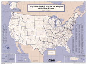
Reference Map119th Congressional District Wall MapsThis wall map depicts congressional district boundaries in effect for the 119th Congress of the United States (January 2025-2027).
-
Redistricting Data Program Congressional DistrictsGuidance and access to information about congressional districts and congressional district products.
Related Information