Census Bureau Data Can Help Communities Prepare for Earthquakes
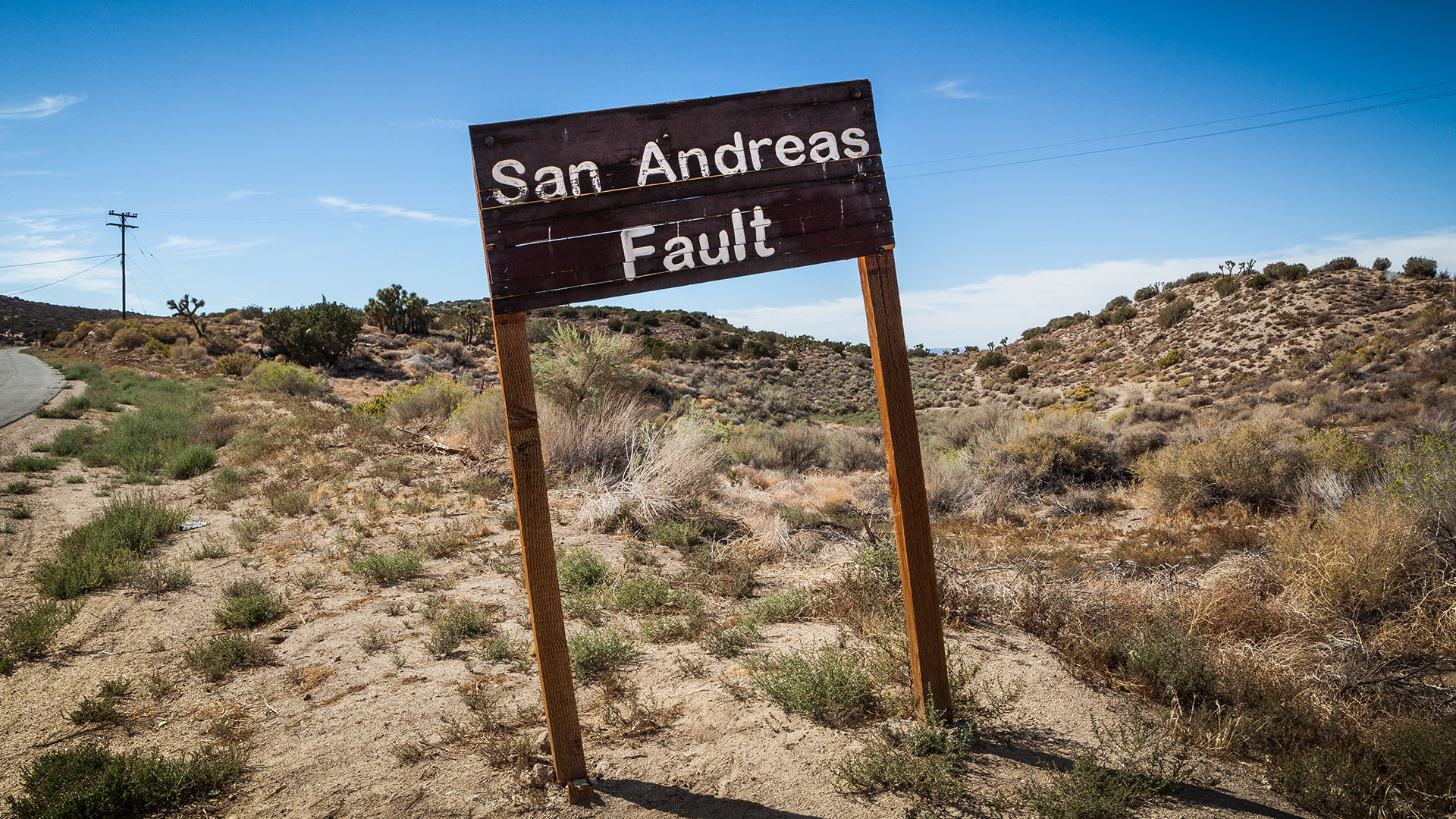
The most destructive earthquake to ever occur in the southeastern United States took place in Charleston, South Carolina, in 1886 and was felt as far away as Wisconsin and Bermuda.
Though the tragedy was long ago, it serves as a powerful reminder that earthquake preparedness is not limited to California, Alaska and other places commonly associated with seismic activity. In fact, South Carolina has about three to five earthquakes strong enough to be felt each year.
On Oct. 15, people around the nation and the world will participate in the 2026 Great ShakeOut.
Similar conditions exist in places across the nation like Hawaii, Nevada, Utah, the Pacific Northwest, the states containing Yellowstone National Park (Idaho, Montana and Wyoming) and those in the New Madrid Seismic Zone beneath parts of Arkansas, Illinois, Kentucky, Missouri and Tennessee.
In short, people living in areas not known for earthquakes should still know the dangers and how to prepare.
On Oct. 15, people around the nation and the world will participate in the 2026 Great ShakeOut. The annual drill encourages individuals, organizations and communities to practice earthquake preparedness.
To better protect their residents, communities also need to understand the people, households, workers and businesses that could be affected by such a disaster.
Using Charleston County, South Carolina as an example, we explore how Census Bureau data can help communities understand their populations before a disaster and support response and recovery afterward.
Identifying Difficulties in Response and Recovery
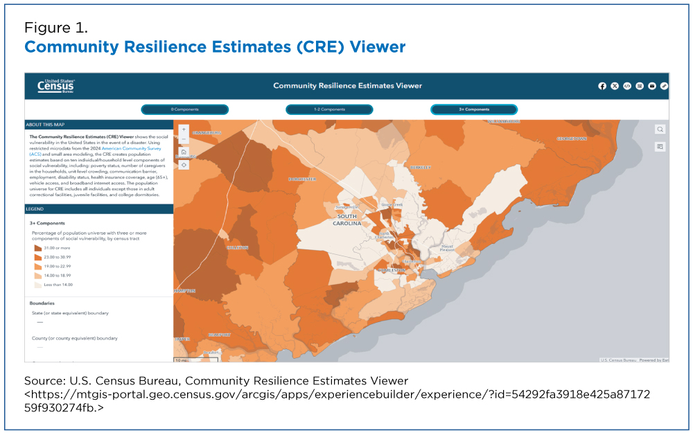
Using the Census Bureau’s Community Resilience Estimates (CRE) data, which measure a community’s ability to weather a disaster, we compare Charleston County, South Carolina to the rest of the nation and find the county would likely have less difficulty responding to and recovering from a disaster than average.
Metropolitan areas often have varied levels of disaster resilience – and a review of Charleston County shows pockets of concern (Figure 1). CRE data help pinpoint these areas so officials can prepare for unique circumstances that may hinder resilience.
Anyone can use the CRE viewer to find out how communities in their area compare.
The CRE Viewer does more than illustrate disaster vulnerability. Using data from the Federal Emergency Management Agency’s National Risk Index (FEMA’s NRI), the tool provides information on communities most at risk to various natural hazards.
Currently, it puts the risk of earthquakes in Charleston at “Relatively High,” the second highest possible rating.
After an Earthquake
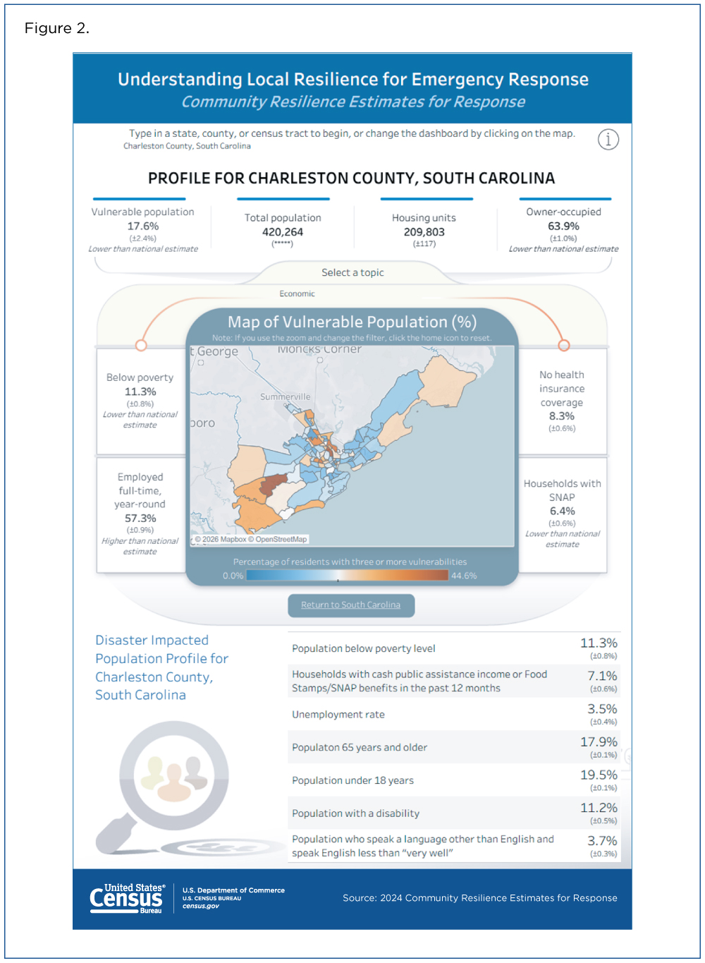
If an earthquake or other disaster occurs, communities can use the CRE Disaster Response Supplement, or “CRE for Response,” to quickly access relevant demographic, housing and socioeconomic data (Figure 2).
These data points can help governments develop “Disaster Impacted Population Profiles,” part of the FEMA Preliminary Damage Assessment, utilized to determine an area’s eligibility for disaster funding.
Workers and Businesses
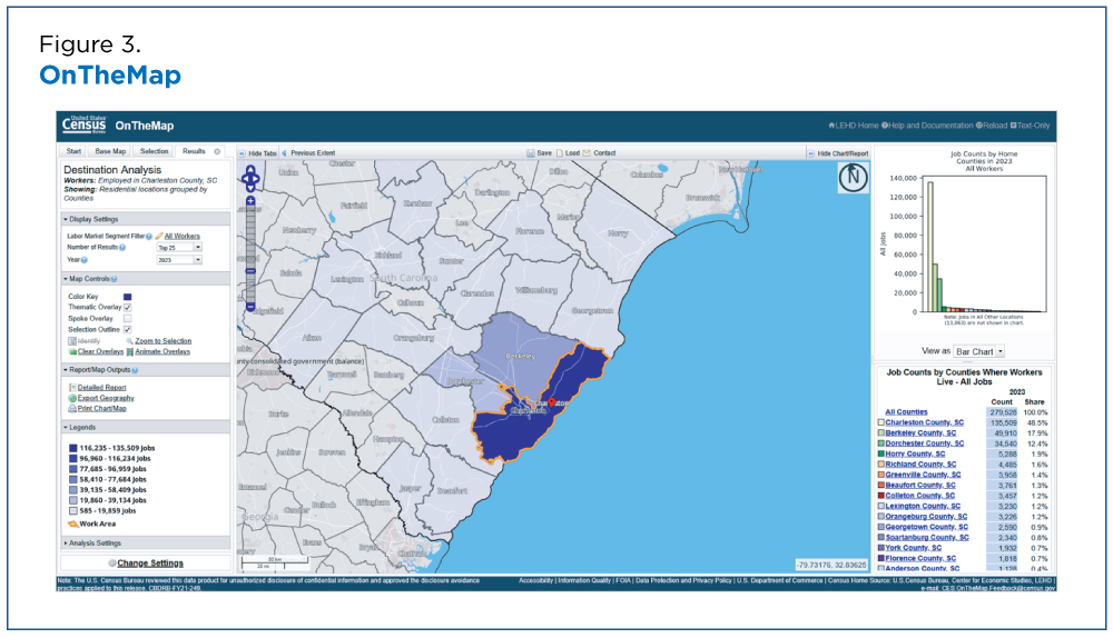
When a disaster hits the residents of a place, it hits workers and businesses, too. The Census Bureau’s OnTheMap tool enables us to gather information about a community’s workers, both where they’re employed and where they live.
Using the tool, we find, for example, that Charleston County has 279,528 jobs, more than half (51.5%) filled by workers living outside the county (Figure 3). This is valuable information when seeking to understand the economic fallout of a potential earthquake.
This type of geographic information is key for disaster planning. For example, areas with many workers living in neighboring communities might prioritize rebuilding commuting infrastructure as part of their recovery efforts.
OnTheMap also offers other geographic details like city- and neighborhood-level data to help identify where recovery efforts will have the largest impact.
Emergency Management Hub
These are just some of the tools available to help communities prepare for and recover from disasters. Additional resources can be found on the Census Bureau’s Emergency Management Hub.
The hub includes data tools, America Counts articles, engaging visualizations and pages tailored to help users swiftly identify information related to key events.
Related Statistics
Subscribe
Our email newsletter is sent out on the day we publish a story. Get an alert directly in your inbox to read, share and blog about our newest stories.
Contact our Public Information Office for media inquiries or interviews.
Related America Counts Stories
-
Emergency PreparednessTornado Activity Shifts East — Heightening Risks in the SouthOctober 07, 2026Census data can help vulnerable communities that have a concentration of mobile homes cope with more frequent tornado activity over a longer season.
-
Emergency PreparednessCalm Atlantic Hurricane Season Could Mean Active One in the PacificSeptember 17, 2026Census Bureau data tools can help communities prepare for and recover from hurricanes and other disasters wherever they are.
-
Business and EconomyMeasuring Weather’s Impact on BusinessOctober 01, 2024The Business Trends and Outlook Survey (BTOS) now collects data on the impact of extreme weather events on business sales.
-
Emergency PreparednessEarthquake Risk May Hit Closer to Home Than You ThinkOctober 14, 2026The 140th anniversary of the Charleston earthquake reminds us of the risks to people, housing and economies in places not typically associated with earthquakes.
-
Emergency PreparednessTornado Activity Shifts East — Heightening Risks in the SouthOctober 07, 2026Census data can help vulnerable communities that have a concentration of mobile homes cope with more frequent tornado activity over a longer season.
-
Families and Living ArrangementsU.S. Parents Gave $26.6 Billion to Their Adult Children in 2024September 30, 2026About 2.6 million parents provided financial support to 3.7 million children age 21 and over who did not live at home.
-
Business and EconomyAmerican Manufacturing: A History in Census DataSeptember 28, 2026On the 15th anniversary of Manufacturing Day, we celebrate the sector’s contribution to the U.S. economy.